 Hiker
How Shawangunk Ridge Formed: Quartz Pebbles to White Cliffs
The pale cliffs of the Gunks tell a story that begins with moving water and durable grains. Their present shape also records deformation and a very long period of erosion.
By HikerQuests · Published · 2 min reading
The download is a self-contained HTML file with text, sources and any diagrams. Save and test opening it before leaving reception; outside links need a connection.

Begin with sand and rounded stones
The State Museum describes the Shawangunk Formation as quartz-rich conglomerate and sandstone with smaller amounts of shale. Much of its sediment accumulated on land around 430 million years ago, in the Silurian Period. That is older than the Devonian deposits highlighted in our Catskills lesson. Sources: [1]
Streams carried material away from older mountains
Feldman, Epstein and Smoliga’s field-study account describes coarse sediment moving west from eastern highlands and accumulating in braided streams and toward a marine basin. It also distinguishes this younger deposit from the older, already deformed Martinsburg rocks beneath it. Do not confuse the deformation of those older rocks with the later history of the ridge’s own layers. Sources: [2]
The layers did not remain level
A New York State Geological Association field guide documents dipping Shawangunk beds and folds. Our illustration shows the idea of tilting schematically; it is not a cross-section of Sam’s Point, Mohonk or one SRT section. Actual orientations and structures vary along the ridge. Sources: [3]
Resistance helps explain the ridge
The Museum links the ridge’s persistence to its quartz-rich rock. Erosion removed surrounding material unevenly, leaving resistant rock prominent. Fractures and later surface processes also matter: a hard mineral does not make an entire cliff unbreakable. Sources: [1]
Read the rock without taking it
Where the maintained trail crosses exposed bedrock safely, look for pebbles held within a finer material. Compare rounded grains inside the rock with cracks that cut across it. The grains and the cracks tell different parts of the story. A photograph is enough; no hammer, scraping or collecting is needed.
Follow the process.
Three simplified stages. The sequence is conceptual; the drawings are not to scale and do not specify a trail’s exact geology.
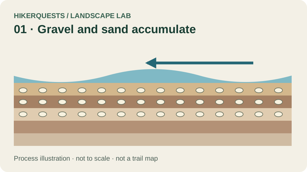
Gravel and sand accumulate
Silurian · around 430 million years ago
Streams carry quartz-rich sediment from older highlands. A schematic gravel deposit begins the sequence. Sources: [1], [2]
Download this original diagram (SVG) ↓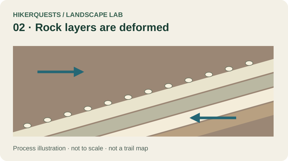
Rock layers are deformed
After deposition and rock formation
The layers are tilted in this conceptual view. Real folds, faults and orientations vary along the ridge. Sources: [3]
Download this original diagram (SVG) ↓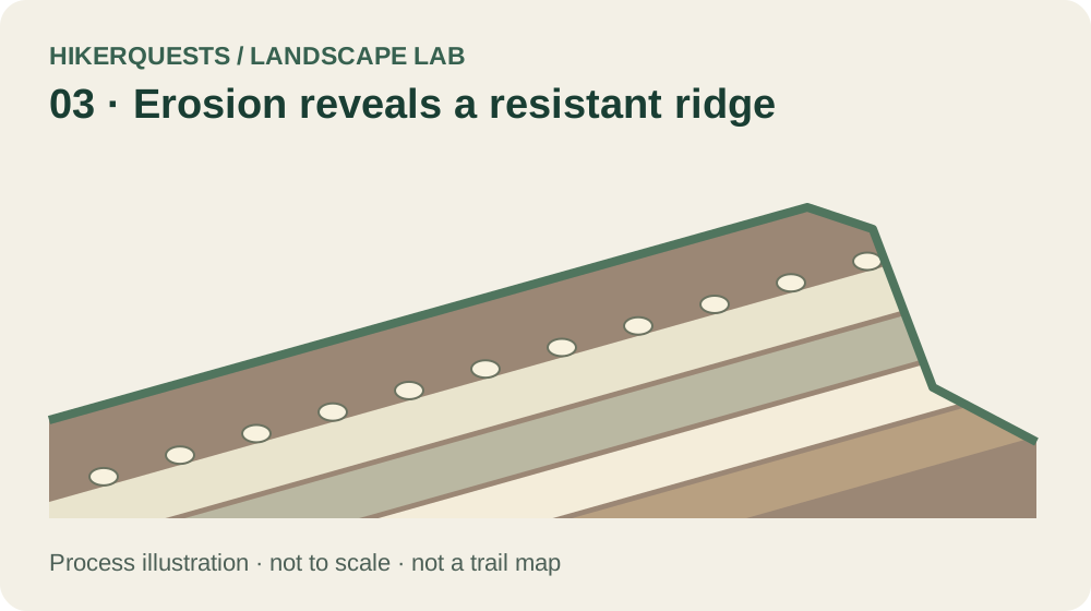
Erosion reveals a resistant ridge
Long erosion and later surface processes
More resistant rock remains prominent as surrounding material wears away. This is not a measured cross-section of a named cliff. Sources: [1]
Download this original diagram (SVG) ↓Sources & reading notes
Checked October 3, 2026. Links lead to original publishers; availability can change. Citations support the adjacent passage, not every possible interpretation of a place.
- New York State Museum · Shawangunk Ridge ↗
Quartz-rich Silurian conglomerate and sandstone, largely terrestrial deposition, about 430 million years ago. Museum article’s indexed text was accessible; direct fetch intermittently returned 502.
- Feldman, Epstein & Smoliga / USGS · Shawangunk and Martinsburg Formations Revisited (2009) ↗
Primary field-study abstract: stratigraphy, source highlands, braided streams and deposition across older deformed Martinsburg rocks.
- New York State Geological Association · 2010 field guide, Trip 1, Epstein (PDF) ↗
Field observations of dipping Shawangunk beds, folds, erratics and till. Diagram tilt is schematic, not a measured cross-section of a particular trail.
Original HikerQuests process illustrations, informed by the sources above. Educational schematics, not measured field sections. Editorial policy.
Keep exploring
- Shawangunk hikes →
- SRT sections and planning →
- Wurtsboro and the southern ridge →
- Compare Catskill bedrock →
- Later glacial clues →