 Hiker
Catskills Hiking Challenges, Fire Towers & Trail Guides
Explore Catskills fire towers, the Catskill 3500 peaks and Long Path sections. Plan your hikes, compare historic maps and track your progress.

Choose a goal for your Catskills hikes
A fire tower checklist, a mountain-climbing challenge and a long-distance trail offer different ways to explore the Catskills. Start with the destination guides below, then check the organizer’s current rules before treating a hike as challenge credit. A summit visit and walking an entire Long Path section are different achievements.
Fire towers or high peaks?
Use the Catskills Fire Tower Challenge page to find the current edition and its destinations. The Catskill 3500 page organizes a different mountain challenge. Keep each hike’s original date in your journal so earlier adventures remain part of your story without being counted toward a later annual edition.
Make the return trip part of the plan
Consider the town nearest your actual finish and return drive. The regional visitor sources linked from hike pages can help you find food and places to explore. Save the hike and consult dated conditions before leaving; an empty report list does not mean the route is clear.
See a second Catskills landscape
Our historic collection includes the Kaaterskill and Woodstock quadrangles. Download an area while connected and compare its old roads and building symbols with a route you recorded. Coverage is partial, and a historic map does not establish current access.
Plan your next step
- Catskills Fire Tower Challenge and current edition →
- Catskill 3500 peaks and checklist →
- Long Path section hiking →
- The historic North–South Lake hotel landscape →
Destinations & section guides

Alder Lake Loop →
DEC lists the lake loop itself as 1.5 miles. Include the approach from parking when budgeting your outing.
Andes Rail Trail & Bullet Hole Spur →
The rail-bed walk and Bullet Hole Spur together make a roughly four-mile return outing.
Ashokan Quarry Trail →
A quarry circuit with an additional loading-area spur and evidence of reservoir construction.
Balsam →
Add this mountain to your hiking journal. Choose a route using the organizer’s current resources, check access, and log your visit when you return.
Balsam Cap →
Add this mountain to your hiking journal. Choose a route using the organizer’s current resources, check access, and log your visit when you return.

Balsam Lake Mountain →
The Mill Brook Road approach to the tower.
Bearpen →
Add this mountain to your hiking journal. Choose a route using the organizer’s current resources, check access, and log your visit when you return.
Big Indian →
Add this mountain to your hiking journal. Choose a route using the organizer’s current resources, check access, and log your visit when you return.
Black Dome →
Add this mountain to your hiking journal. Choose a route using the organizer’s current resources, check access, and log your visit when you return.
Blackhead →
Add this mountain to your hiking journal. Choose a route using the organizer’s current resources, check access, and log your visit when you return.
Bramley Mountain →
A loop to a restored tower near Delhi.

Bramley Mountain · Full Trail Loop →
Complete the trail loop through quarry country and the summit.
Catskills Visitor Center Interpretive Loop →
A short interpretive walk and a place to get oriented to the Catskills.
Cornell →
Add this mountain to your hiking journal. Choose a route using the organizer’s current resources, check access, and log your visit when you return.
Delhi Trails · Complete System →
A four-trail network on and near Mount Crawford. CMC lists about 5.4 miles of trail, which is not a ready-made parking-to-parking itinerary.
Diamond Notch Falls →
A falls destination reached by more than one approach.
Eagle →
Add this mountain to your hiking journal. Choose a route using the organizer’s current resources, check access, and log your visit when you return.
Fir →
Add this mountain to your hiking journal. Choose a route using the organizer’s current resources, check access, and log your visit when you return.
Frick Pond loop from Beech Mountain Road →
Frick Pond is the shorter choice beside the longer Hodge Pond circuit. Make it the complete plan if the group wants time to pause without committing to a longer forest tour.
Friday →
Add this mountain to your hiking journal. Choose a route using the organizer’s current resources, check access, and log your visit when you return.
Giant Ledge from Oliverea Road North →
This entry uses DEC’s Slide Mountain Wilderness description: the yellow Phoenicia East Branch Trail connects to the blue Giant Ledge–Panther Trail. The outing turns around at Giant Ledge. Panther is a separate…
Halcott →
Add this mountain to your hiking journal. Choose a route using the organizer’s current resources, check access, and log your visit when you return.
Hodge Pond loop via Flynn and Quick Lake trails →
Hodge Pond is a separate commitment from the shorter neighboring pond loop. Agree on the complete circuit and available daylight before leaving the trailhead.
Hunter Mountain →
Spruceton approach to the high country.
Indian Head →
Add this mountain to your hiking journal. Choose a route using the organizer’s current resources, check access, and log your visit when you return.
Kaaterskill Falls observation platform from Laurel House Road →
Choose the observation platform as the complete Kaaterskill itinerary. It is a different outing from descending to the lower falls, and the shared plan should say so.
Kaaterskill High Peak →
Add this mountain to your hiking journal. Choose a route using the organizer’s current resources, check access, and log your visit when you return.
Kanape Brook valley walk from Peekamoose Road →
Make the valley the destination on this Kanape Brook plan. An Ashokan High Point summit guide describes a longer day even when it starts from the same parking area.
Lone →
Add this mountain to your hiking journal. Choose a route using the organizer’s current resources, check access, and log your visit when you return.
Long Path 16 · Riggsville to Bull Run →
Vernooy Falls and the Sundown landscape introduce the southern Catskills. Woodland and old-road walking give way to rougher terrain and a steep descent toward the Bull Run end.
Long Path 17 · Bull Run to Denning Road →
Peekamoose and Table make this a demanding mountain section. The initial climb gains substantial elevation before the route crosses the ridge and descends toward the Neversink drainage and Denning.
Long Path 18 · Denning Road to Wittenberg Mountain →
The route climbs from the Neversink valley into Slide Mountain Wilderness, following the Burroughs Range toward Cornell and Wittenberg. Terrain and elevation gain matter much more than the mileage alone.
Long Path 19 · Wittenberg Mountain to Phoenicia →
A mountain-to-village traverse through the Mount Pleasant and Romer area toward Phoenicia. A long descent and several ridges make this an ambitious approach to an Esopus-side finish.
Long Path 20 · Phoenicia to Silver Hollow Notch →
Tremper’s fire tower is one landmark on this longer traverse toward Silver Hollow. Warner Creek is an unbridged crossing; a tower visit alone does not complete the entire section.
Long Path 21 · Silver Hollow Notch to Platte Clove Road →
The eastern Devil’s Path crosses Plateau, Sugarloaf, Twin and Indian Head. Repeated climbs, ledges and scrambling make this one of the most strenuous stretches of the Long Path.
Long Path 22 · Platte Clove Road to Palenville →
Kaaterskill High Peak’s northern slopes lead toward Palenville, combining gentler old-road or snowmobile-trail walking with a steeper descent. Quarry and transport history add another layer to the woodland landscape.
Long Path 23 · Palenville to North Lake Campground →
Historic travel routes climb from Palenville toward North–South Lake. The Harding Road and former grand-hotel landscape invite comparison between modern trails and nineteenth-century mountain tourism.
Long Path 24 · North Lake CG to Batavia Kill →
Escarpment walking links the North Lake area with Blackhead and Batavia Kill. North Point and Dutcher Notch are landmarks on a route that includes serious climbing and a steep descent.
Long Path 25 · Batavia Kill to NY Route 23 →
Windham High Peak forms the final Catskill Park mountain stage on the northbound route. The Elm Ridge landscape also preserves a reforestation story in planted conifer stands.
Long Path 26 · NY Route 23 to Greene County →
The route passes through a patchwork of state forest and watershed land north of NY 23. Old roads and Mount Hayden country give a quieter character than the better-known Catskill summits.
Long Path 27 · Greene County to Schoharie County →
Mount Pisgah and the South Mountain landscape link Greene and Schoharie counties. Woods roads, planted forest and ridge terrain make this a transition into the northern Long Path’s rural country.

Mount Utsayantha →
A summit park above Stamford.
North Dome →
Add this mountain to your hiking journal. Choose a route using the organizer’s current resources, check access, and log your visit when you return.
Onteora Lake →
Choose the organizer’s Onteora Lake outing from a network of trails.

Overlook Mountain →
Steady climbing above Woodstock.
Palmer Hill · Both Meadow Loops →
An open-country walk combining the approach and both meadow loops.
Panther →
Add this mountain to your hiking journal. Choose a route using the organizer’s current resources, check access, and log your visit when you return.
Peekamoose →
Add this mountain to your hiking journal. Choose a route using the organizer’s current resources, check access, and log your visit when you return.
Plateau →
Add this mountain to your hiking journal. Choose a route using the organizer’s current resources, check access, and log your visit when you return.
Plattekill Falls · Platte Clove →
A short waterfall route where steep terrain matters more than mileage.
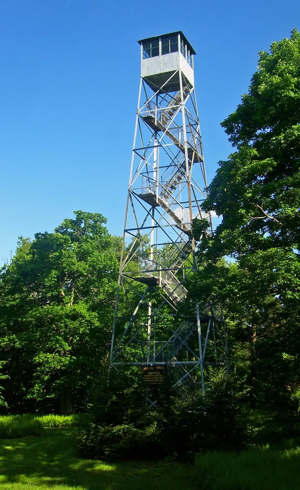
Red Hill →
A forest climb from the Dinch Road approach.
Rochester Hollow →
Choose your route through the Rochester Hollow network before setting a turnaround time.
Rocky →
Add this mountain to your hiking journal. Choose a route using the organizer’s current resources, check access, and log your visit when you return.
Rusk →
Add this mountain to your hiking journal. Choose a route using the organizer’s current resources, check access, and log your visit when you return.
Shavertown & Tremperskill Overlook →
Climb toward Snake Pond and continue on the current Tremperskill Overlook route.
Sherrill →
Add this mountain to your hiking journal. Choose a route using the organizer’s current resources, check access, and log your visit when you return.
Slide →
Add this mountain to your hiking journal. Choose a route using the organizer’s current resources, check access, and log your visit when you return.
Southwest Hunter →
Add this mountain to your hiking journal. Choose a route using the organizer’s current resources, check access, and log your visit when you return.
Sugarloaf →
Add this mountain to your hiking journal. Choose a route using the organizer’s current resources, check access, and log your visit when you return.
Table →
Add this mountain to your hiking journal. Choose a route using the organizer’s current resources, check access, and log your visit when you return.
Thomas Cole →
Add this mountain to your hiking journal. Choose a route using the organizer’s current resources, check access, and log your visit when you return.

Tremper Mountain →
A rocky climb above the Esopus valley.
Trout Pond from Russell Brook →
DEC places the south shore 0.9 mile from the parking lot; 1.8 miles return is a calculation for that turnaround only.
Twin →
Add this mountain to your hiking journal. Choose a route using the organizer’s current resources, check access, and log your visit when you return.
Upper Esopus Fire Tower →
Begin at the Catskills Visitor Center.
Vernooy Kill Falls →
A waterfall outing with rocky footing and some steeper sections.
Vly →
Add this mountain to your hiking journal. Choose a route using the organizer’s current resources, check access, and log your visit when you return.
West Kill →
Add this mountain to your hiking journal. Choose a route using the organizer’s current resources, check access, and log your visit when you return.
Windham High Peak →
Add this mountain to your hiking journal. Choose a route using the organizer’s current resources, check access, and log your visit when you return.
Wittenberg →
Add this mountain to your hiking journal. Choose a route using the organizer’s current resources, check access, and log your visit when you return.
HikerQuests planning guide · published October 3, 2026. Read how our guides, sources and community observations are handled.


